Pennsylvania has continued to issue occasional 'Official' road maps into the new century; however there are rumors some states have stopped issuing maps due to the rise of car navigation systems and GPS.
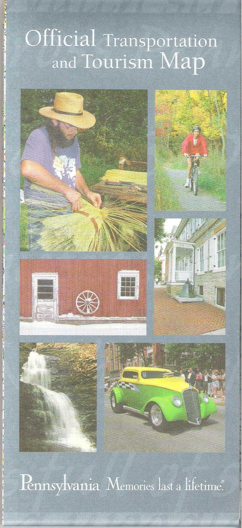 |
2000
This official map has the website of the Department of
Transportation:
www.dot.state.pa.us
. It is 27 x 44 inches and here is the map image. |
 |
2000
This turnpike map began several years using the same cover design. The size remained the same. |
 |
2001
No official map issued. This map was put out by the Department of Conservation; here is the map image. The layout is similar to the "official" maps, but this one is 22 x 36 inches. |
 |
2002
This map has the same image on the cover as the 2000 map, but the lettering on the front is slightly different. Also, on the verso is a new message from Governor Mark Schweiker, who took over after Tom Ridge resigned and decamped to Washington, D.C. to join the Bush cabinet. |
 |
2002
Pennsylvania Turnpike Commission Map and Travel Guide, Computer generated by Department of Transportation Geographic Information Division, Pennsylvania Turnpike Commission. This map is surrounded by a figurative strip map of the turnpike as shown here. This format began with the 2000 map above. City maps on the verso. |
 |
2003
There are several tourist attractions featured on the cover of this 27 x 44 inch map. The elk is part of a ~500 or so herd that roams (yes) Elk County and parts of the surrounding counties. Elk became extinct in Pennsylvania in the late 1800s or early 1900s and this herd was started with a small group brought from the Rocky Mountains. |
 |
2003
This turnpike map is a continuation of the previous years' design. |
 |
2004
No official map issued. Road construction locations are shown on this colorful small figurative map; here is the map image.
|
 |
2004
The cover has changed for this year's turnpike map, but the size and layout remained the same.
|
 |
2005
This map is the same size as the 2003 map but updated; here is the map image. |
 |
2006
This photo is not real, but a composite image. The framing architecture and the couple on the bench are in the Carnegie Museum in Pittsburgh and the river view is along the Delaware in Bucks County. The map is similar to the previous ones, but updated.
|
 |
2007
This is a view of Pittsburgh from the West End park. The basic map design is the same as previous ones. |
 |
2007
Fallingwater, designed by Frank Lloyd Wright, is the most famous structure in western Pennsylvania. It is located in the Laurel Highlands not far from Ohiopyle State Park. This map, or the one above, were possibly intended for 2008 but dated 2007. |
| |
2008
No official map issued. |
 |
2009
This scene is presumably from somewhere in Adams or York counties. Here is the map image; and the same basic design, except for upgrades, has been used for the last ten years. |
 |
2010
Nice shot of Johnstown and its defining features, the rivers and the incline. |
 |
2011
The picture shows the Pennsylvania State House in Philadelphia, otherwise known as Independence Hall. |
 |
2011
This turnpike map cover uses images that appear to come from old postcards. The size is 18 x 24 inches. |
 |
2012
The kayaker is kayaking on the Susquehanna River. |
 |
2013
The cannon is sitting in Gettysburg National Military Park. |
 |
2014
The 10 string guitar dates from the mid 19th century and was made by C.F. Martin, a Pennsylvania company. One of the few state map covers to recognize a local industry. |
 |
2015
Scenic drive time. |
 |
2016
The street scene is Franklin, Venango County, a center of the old (and orginal) oil industry. |
 |
2017
The scene is Ohiopyle State Park, one of the largest and most scenic of the many state parks. |
 |
2018
The scene is Kinzua Bridge State Park, the site of a 19th century high level railroad bridge, once the longest and highest around. It was partially destroyed by a tornado in 2003, and one remaining side was converted to a pedestrian walkway in 2011. Visitors can walk out to about the midpoint of the original bridge and enjoy the view. |
 |
2019
Pennsylvania has several ski areas, the largest being Seven Springs in Somerset County.
The reverse side of this map cover has the 2018 cover. |
 |
2020
The Blue Rocks, shown in this photo, is a geologically significant large boulder field in the middle of forest and farmland west of Allentown. |
Page added August, 2011.