|
WELCOME |
Road Maps of Pennsylvania |
WELCOME |
 Christopher Colles produced the first
United States road maps in 1789. His atlas showed roads
connecting a few cities, including Philadelphia
in Pennsylvania, and was modeled after
the English road guides of the 18th century. In 1796 Abraham
Bradley made a large map of the United States showing the roads
of the new nation
(Pennsylvania detail)
. This map, and its subsequent
derivatives, became the official map of the US Post Office for
planning mail deliveries; it is reproduced in Ristow and also
Schwartz & Ehrenberg. In 1802 T. W. Jones and S. S. Moore
produced a road guide similar to Colles called The Traveller's
Directory, or A Pocket Companion, published by Mathew Carey,
Philadelphia.
Christopher Colles produced the first
United States road maps in 1789. His atlas showed roads
connecting a few cities, including Philadelphia
in Pennsylvania, and was modeled after
the English road guides of the 18th century. In 1796 Abraham
Bradley made a large map of the United States showing the roads
of the new nation
(Pennsylvania detail)
. This map, and its subsequent
derivatives, became the official map of the US Post Office for
planning mail deliveries; it is reproduced in Ristow and also
Schwartz & Ehrenberg. In 1802 T. W. Jones and S. S. Moore
produced a road guide similar to Colles called The Traveller's
Directory, or A Pocket Companion, published by Mathew Carey,
Philadelphia.
The old Lancaster Turnpike
running from Philadelphia to Lancaster was the first long
distance stone and gravel surface road in the country; see
Hulbert, Rose, and this
1776 road map
from the Library of Congress. It was
built to provide cheap transportation from the breadbasket
counties of Lancaster and York to Philadelphia. The Philadelphia
and Lancaster Turnpike Road Company was granted a charter in 1792
and completed the road in 1795. Nine toll gates were constructed
over the 62 mile distance. Pennsylvania also contains a portion
of the only road built in the 19th century by the Federal
government, the old National Road US 40, running from Cumberland
into Ohio. It crosses the state in the southwest and had several
toll gatehouses, one or two still standing today. The first
iron bridge in the
United States was completed in 1839 over Dunlap's Creek (
Brownsville) on the route of the National Road and replaced a
succession of bridges at this location.The work was done as part
of a reconstruction of the road 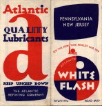 by
the Federal government prior to turning it over to the states for
maintainance. The span is 80 feet and it still stands, a National
Historic Engineering Landmark. And Pennsylvania built the first
modern four lane highway in the United States, the Pennsylvania
Turnpike. The first
segment ran from west of Harrisburg to just east of Pittsburgh
and opened for business in 1940.
by
the Federal government prior to turning it over to the states for
maintainance. The span is 80 feet and it still stands, a National
Historic Engineering Landmark. And Pennsylvania built the first
modern four lane highway in the United States, the Pennsylvania
Turnpike. The first
segment ran from west of Harrisburg to just east of Pittsburgh
and opened for business in 1940.
Early 19th century maps
typically indicated major roads, but with the coming of railroads
mapmakers began showing rail lines (and canals) rather than roads.
County atlases in the late 19th century would show roads on large
scale county, township, and urban maps, and detailed road maps
were published by bicycle clubs. In the early 20th century
publishers again began to show main roads on atlas maps as car
travel increased, and they began publishing road maps
specifically for motorists. Some general American automobile road
map history can be found in articles by Ristow (1946) and Yagoda,
and in the book Hitting the Road by Yorke &
Margolies. For a history of the Federal government involvement in
funding and building roads, see USDOT in the references. A
history of European road maps can be found at
cartes routieres anciennes
(old road maps).
Early automobile road maps
had no route numbers. Major roads had historic names, i. e.
National Road, Lincoln Highway, that appeared on road signs and
maps. Early publishers of road maps created their own route
numbers, and gave detailed driving instructions on how to get
from place to place as route signs did not exist then. The state
Highway Department used an internal system of route numbering
from 1911 to 1925 that appeared on state produced maps but not on
road signs or tourist maps. Trail or pole markings along the
roads first appeared around 1917 and were an extension of the
road name system. For example, the Lincoln Highway (US Route 30
today) was identified by a large blue L that could be seen on
telephone poles or fence posts along the way. Old state route
numbers first appear in 1925 and modern US route numbers in 1926
on a few major roads, i. e. US 30 and US 40. For more on early
route numbering, see The Pennsylvania
State Route Numbering System
.
Oil company road maps have a
special significance for Pennsylvania because the oil industry
started near Titusville with Edwin Drake's oil well in 1859. Gulf,
based in Pittsburgh, was the first oil company to hand out free
road maps beginning in 1914; these maps carried route numbers
that referred to detailed driving instructions published by the
Automobile Blue Book Publishing Company. Most other oil companies
began distributing maps in the 1920's, when route signs made
using a simple map more feasible. General Drafting, Rand McNally,
and H. M. Gousha dominated oil company road map publishing; other
names were Mid-West, National Survey, Gallup, Diversified Map, R.
R. Donnelly. Rand McNally began making maps for Gulf in 1922.
General Drafting made maps almost exclusively for Standard Oil (Esso)
beginning in 1923. The first Gousha oil company maps appeared in
1927.
 Maps
dated 1916 or earlier contain only publisher route numbers or
road names. Maps dated 1917 to 1926 usually contain trail
markings. Maps dated 1925-26 contain trail markings and/or old
state route numbers. Maps dated 1926-28 may contain both old
state and modern US route numbers on major roads. From 1928 on
modern route numbers appear on all road maps. For a discussion and look at
early road atlases, see
Pennsylvania in Old Road
Atlases.
Maps
dated 1916 or earlier contain only publisher route numbers or
road names. Maps dated 1917 to 1926 usually contain trail
markings. Maps dated 1925-26 contain trail markings and/or old
state route numbers. Maps dated 1926-28 may contain both old
state and modern US route numbers on major roads. From 1928 on
modern route numbers appear on all road maps. For a discussion and look at
early road atlases, see
Pennsylvania in Old Road
Atlases.
Road maps are divided
here into three categories. State
Road Maps
are those published by a state
agency, usually the 'official' road map put out by the Highway
Department.
Oil Company Road Maps
are those with an oil logo
usually published by Rand McNally, H. M. Gousha, or General Drafting. General
Road Maps
are those not in the first two
categories, though many also came from Rand McNally. This site
may be searched using the search engine below.