


| WELCOME | The 1872 Atlas of Pennsylvania | WELCOME |
The New Topographical Atlas of the State of Pennsylvania by Walling & Gray, to give it the cover page title, was the first real atlas of the state. Some earlier books had appeared with county maps, but were not folio size atlases. This atlas is about 17 x 14 inches, and some of the maps are double page or 17 x 28 inches. Henry F. Walling was associated with Lafayette College in Easton, Pennsylvania. Otis W. Gray was a Civil Engineer in Philadelphia. In addition to Pennsylvania, Walling & Gray authored atlases of Massachusetts in 1871 and Ohio in 1872. Walling alone, or with other authors, put out atlases of other states in the northeast and midwest such as Wisconsin, Illinois, and New Hampshire. O.W. Gray & Son was a well known Philadelphia atlas maker in the 1870s and 1880s with The National Atlas, containing elaborate topographical maps of the United States and the Dominion of Canada, with plans of cities and general maps of the world, Philadelphia 1875 with subsequent editions; and Atlas of the United States, with general maps of the world, Stedman, Brown & Lyon, Philadelphia 1873, with subsequent editions. The Grays also put out county atlases. So both Walling and Gray were veteran atlas authors when the Pennsylvania atlas appeared. Stedman, Brown & Lyon of Philadelphia published many atlases, maps, panoramic maps, and other lithographic material, including most of the atlases associated with both Walling and Gray.
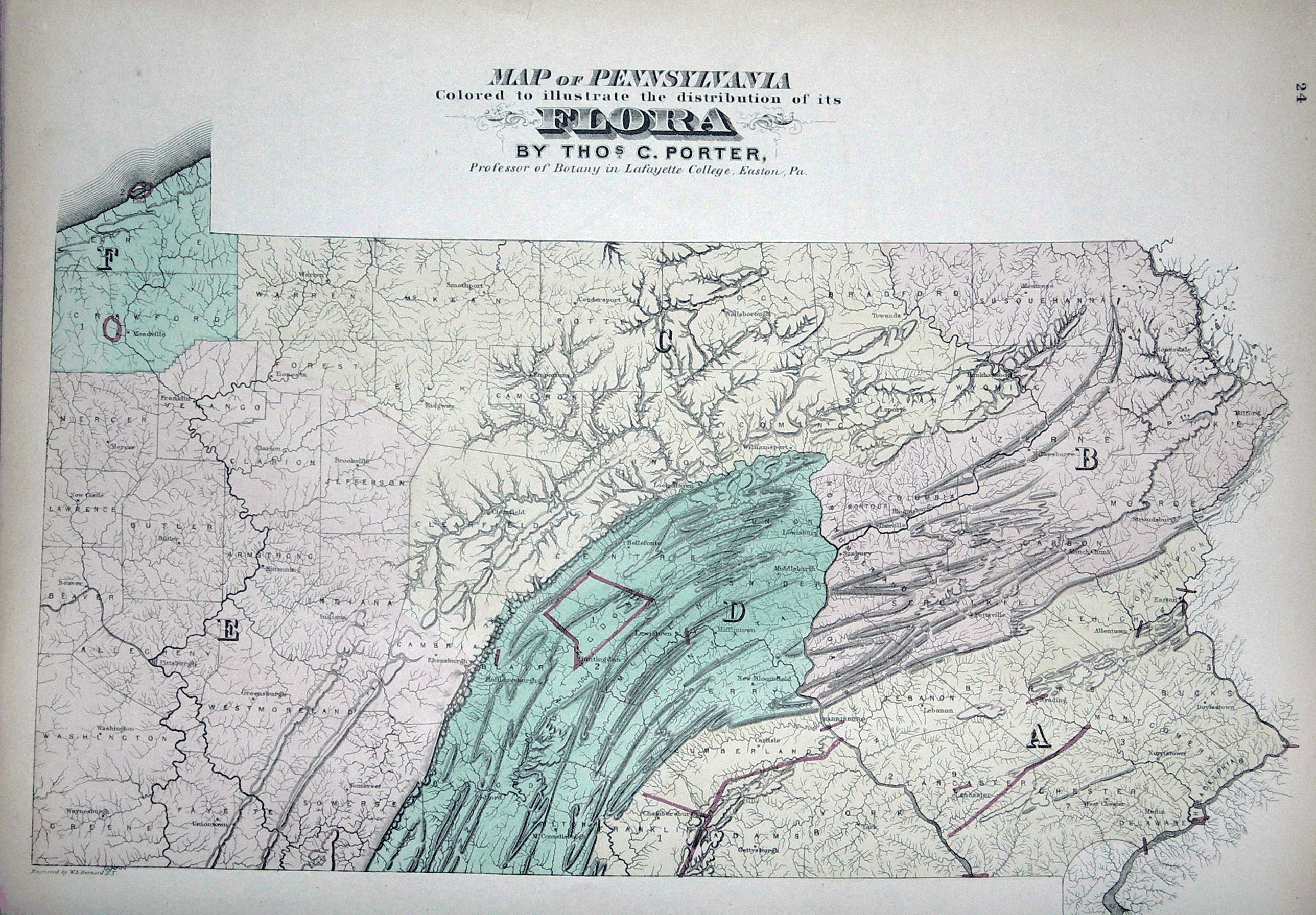
Walling appears to have been the main editor while Gray provided the maps. The United States and Pennsylvania maps from Gray appeared in other places, like some of the county atlases. Likewise some of the city maps appeared in other places, for example the Pittsburgh map is from G. M. Hopkins. The county maps, however, are unique to this 1872 atlas. Other familiar names in Pennsylvania mapping associated with the atlas are J. Peter Lesley, who assisted Henry Darwin Rogers in the first Geological Survey and who became the Chief Geologist on the Second Geological Survey. P. W. Shaefer, known for his 1875 Historical Map of Pennsylvania and earlier maps of the coal industry, provided a graph on the coal trade. Walling also recruited associates at Lafayette College, such as Thomas Porter, a professor of botany. Other authors include Lorin Blodget on climatology and J. R. Sypher on history and education, and some others. The text with no identified author was likely written by Walling.
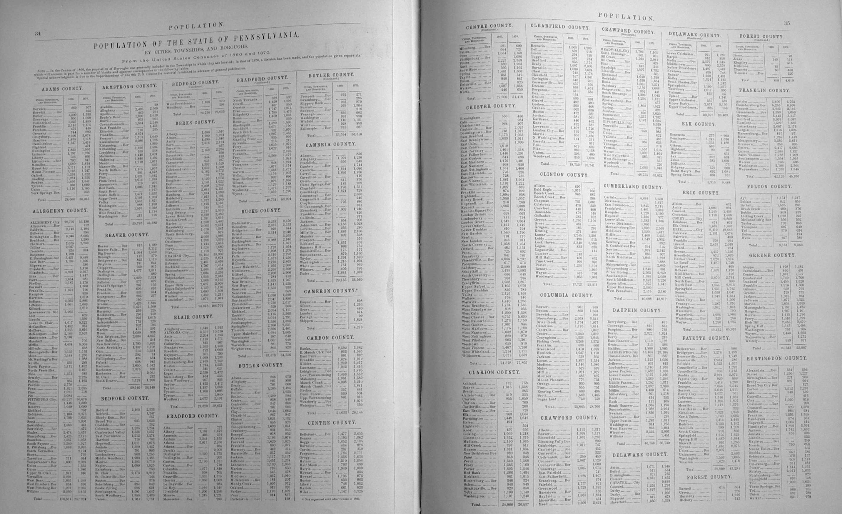
The 132 pages from the atlas are reproduced below.
|
|
|
|
|
|
|
|
|
|
|
|
|
|
|
|
|
|
|
|
|
|
|
|
|
|
|
|
|
|
|
|
|
|
|
|
|
|
|
|
|
|
|
|
|
|
|
|
|
|
|
|
|
|
|
|
|
|
|
|
|
|
|
|
|
|
|
|
|
|
|
|
|
|
|
|
|
|
|
|
|
|
|
|
|
|
| Home Page | 16th Century Maps | 17th Century Maps | 18th Century Maps | 19th Century Maps | 20th Century Maps | References |