


| WELCOME | Articles on Historical Maps of Pennsylvania | WELCOME |
Pennsylvania in Old Road Atlases 1921 - 1925
|
|
1921 OFFICIAL AUTOMOBILE BLUE BOOK, VOL, 3 1921 N.J., PA., MD.,DEL., VA., W.VA., D.C. Copyright 1921 by The Automobile Blue Book Publishing Co. This is a 968 page book with the usual route directions, ads, and maps. In the front are several pages of skeleton route maps, as shown by the one for western Pennsylvania at left. The bulk of the book is text with route directions interspersed with ads and small maps. At the back are over a hundred pages of larger scale maps covering the area shown by the grid map on pages 760-761 . Size: 9.25 x 5.5 inches. 3381 |
|
|
1921 OFFICIAL AUTOMOBILE TOUR BOOK 1921 AAA New York, Pennsylvania, New England And Points In Adjacent States And Canada. Compiled By Dai. H. Lewis. Published by The Automobile Club Of Buffalo. This book of 724 pages is very similar to the 1920 edition shown elsewhere here. Route directions through New York comprise most of the book with few maps. Pages 399 , 400-401 , 402-403 describe a route from Bradford through Ridgway, Dubois, Punxsutawney, Kittanning, and eventually into Pittsburgh, with maps. 9.25 x 6 inches. 3433 |
|
|
1921 RAND MCNALLY OFFICIAL AUTO TRAILS MAP - EASTERN OHIO, WESTERN PENNSYLVANIA, SOUTH EAST MICHIGAN SOUTHERN ONTARIO WESTERN NEW YORK DISTRICT NO. 4. Copyright 1921 by Rand McNally & Co. Chicago. This 44 page booklet has a large 28 x 21 inch foldout map attached to the back. The portion with western Pennsylvania is shown at left; the "auto trails" are in heavier line. As in the previous booklets, the pages contain a list of cities arranged alphabetically with names of hotels and garages, no route directions. Pages 34-35 have a double page map of Pittsburgh. Rand McNally booklets now cover the entire country as shown by the map on pages 6-7 . The "Indian painting a rock" cover used for the first time on this 1921 edition remained the logo cover for the next ten years. 7.5 x 4 inches. 2416 |
|
|
1921 GOOD ROADS ATLAS OF THE UNITED STATES. The George F. Cram Co., Chicago. This undated 100 page road atlas and gazetteer has 1920 census data and uses auto trails, so dates circa 1920-25. Legear (L322) and other sources date it to 1921. Cram could lay claim to publishing the first modern road atlas, and this is it. It's all here: folio size, United States map in front, some useful information on national parks, maps of all the states, and a town and county gazetteer at the back. There is just one minor problem: the maps are not true road maps. A standard atlas map has been overlaid with red route markings instead, as shown by the Pennsylvania map at left. Pennsylvania rates double page coverage, west and east. So, whether this is considered the first modern road atlas or not, it certainly set the pattern. Size: 15 x 12 inches. 4426 |
|
|
1922 NUFOLD ROAD GUIDE PENNSYLVANIA IMPROVED HIGHWAYS MAIN CONNECTING ROADS AND MILEAGE CITY MAPS AND ROUTINGS. Published by United States Survey Company, Rochester, N.Y. This 32 page booklet is undated but can be dated to late 1921 or early 1922 by text: "Highways designated for 1922 construction... ." It contains road directions from towns in a sort of alphabetical order as shown on pages 2-3 for towns starting with "A." The pages also have city street maps, Allentown, Bethlehem, Altoona, and Hollidaysburg here, and ads as shown. Folded into the back is the large 24 x 40 inch map shown at left with main routes in red line. This is an unusually attractive map of Pennsylvania, and the Nufold guides had both attractive covers and maps. 9.5 x 5 inches.1374 |
|
|
1922 PENNSYLVANIA HISTORICAL AND DESCRIPTIVE GUIDE AND INDEX. Published by The National Survey Company, Chester, Vermont. This 85 page booklet has a plain cover so the title page is shown at far left. It is undated but uses 1920 census data and appears early 20s, so 1922 is used here. The first 35 pages contain an alphabetical listing of town names along with ads and short blurbs for some towns; for example this page of "Hs" has a small picture of the State Capitol Building. The next 50 pages are detailed road maps such as the northwest corner of the state shown at left. Main roads are marked in red and city maps are included such as the map of Erie here. The last page has a map of New England showing the location of Chester. National Survey also made a large wall map of the state, but this booklet was a more convenient format for a traveler. 9 x 5.5 inches. 1262 |
|
|
1922 AUTO TRAILS AND COMMERCIAL SURVEY OF THE UNITED STATES. The George F. Cram Co., Chicago. This 136 page road atlas and gazetteer is undated, but has a 1922 purchase stamp on the title page, shown at far left as the cover on this copy is not very legible. LeGear (L324) also gives a 1922 date for this atlas. This is the second edition of the Cram road atlas started in 1921 as shown above. Some additions have been made, with various kinds of useful information such as a list of national parks, a page of colorful pole markers for routes, maps of all the states, and a town and county gazetteer at the back. Like the previous atlas, there is just one minor problem: the maps are not true road maps. A standard atlas map has been overlaid with red route markings instead, as shown by the Pennsylvania map at left. Two maps are included for each state: a " road map " and a " commercial map " showing rail lines with trolley (or electric) lines in red. This atlas was issued undated from 1922 to around 1926, and the various editions are hard to tell apart. Size: 15 x 12 inches. 3263 |
|
|
1922 AUTO ROAD GUIDE Covering all Sections in Eastern Pennsylvania, New Jersey, Delaware and Parts of Maryland and Virginia. This is a 24 page advertising booklet from Seip's Cafe, South Third Street, Easton, Pa. Sections are taken from The Handy-Dandy Automobile Guide, Copyright 1922 by George D. Proud; such as the double page route guide shown at left which covers the northeast and midwest. In the back is a similar map of the southeast. The road directions are minimal, just mileage between towns as shown on pages 2-3 . Page 2 has a description of Easton. Size: 9 x 4 inches. 3064 |
|
|
1922 MIDDLE ATLANTIC & SOUTHEASTERN AUTOMOBILE BLUE BOOK 1922, Entire Country in Four Volumes (Volume 2) Complete Touring Data on 85,000 Miles of Automobile Roads in Penn., N.J., Del., Md., Va., W.Va., D.C., Tenn., N.C., S.C., Miss., Ala., Ga., Fla., and eastern Louisiana. Copyright 1921 by The Automobile Blue Books Corporation. With this edition, the coverage of the country was reduced to four volumes as the title says. This may have been done for convenience, but more likely to save money. This 1066 page book covers three times the territory of the previous ~1000 page edition for the Pennsylvania region, so coverage is more condensed. In the front are several pages of skeleton maps similar to the previous editon and at the back over a hundred pages of detailed road maps for the mid-Atlantic region, also similar to the previous edtion. Also at the back is the General Index Map for the northeast shown at left; the verso has the southeast. As usual, the bulk of the book consists of route directions illustrated here by pages 302-303 , 304-305 , 306-307 . They show the route from Pittsburgh to Bedford and can be compared to the same route shown in previous editions. For one thing, the description is more concise, and for two things, there are more ads. Size: 9.25 x 5.5 inches. 3409 |
|
|
1922 RAND MCNALLY OFFICIAL AUTO TRAILS MAP PENNSYLVANIA NEW JERSEY NORTHERN WEST VIRGINIA MARYLAND, DELAWARE DISTRICT NO. 7. Copyright 1922 by Rand McNally & Co., Chicago. This 64 page booklet has a large 27 x 35 inch map folded into the back and shown at left. District 7 now covers all of Pennsylvania except a narrow strip of the west. The text still consists of an alphabetical list of towns with hotels and garages illustrated here by pages 26-27 with a map of Harrisburg. Size: 7.5 x 4 inches. 0334 |
|
|
1922 RAND MCNALLY BLACK AND WHITE MILEGE ATLAS OF THE UNITED STATES CANADA AND MEXICO AND HOTEL DIRECTORY WITH RATES AND ACCOMODATIONS, Rand McNally & Company, Chicago. Copyright 1922. This large atlas has about 203 pages illustrating 21 Rand McNally District Auto Trails maps covering the United States as shown on the Table of Contents page. The Pennsylvania District 7 map is shown at left which includes most of the state, and is similar to the District 7 map shown above. The atlas also includes 'black & white mileage maps' of all the states plus Canada and Mexico; the Pennsylvania example is shown here.There is an extensive gazetteer with the "rates and accomodations." This is another atlas that can lay claim to being among the earliest road atlases. Size: 21 x 15 inches. |
|
|
1923 OFFICIAL AUTOMOBILE BLUE BOOK, VOL. 2 1923 Middle Atlantic and Southeastern States. Copyright 1922 by Automobile Blue Books, Inc. Chicago. The condensation of blue books begun with the 1922 edition above continues here, with only 750 pages. The 100+ page block of detailed road maps for the mid-Atlantic in previous editions is gone. A plastic folder at the back contains the 23 x 32 inch General Index Map with the northeast side shown at left; the southeast is on the verso. There is also a 18 x 10 inch Route Chart with New York City area maps on the verso. The general road directions are illustrated here by pages 232-233 with the route from Dubois to Pittsburgh, which can be compared with the same route shown for the 1918 edition. There are city maps and ads throughout the book. The four volume coverage of the US, of which this is volume 2, is shown by this map . Size: 9.25 x 5.5 inches. 3394 |
|
|
1923 ATLAS BEST ROADS OF THE UNITED STATES Paved Roads State Highways Road Distances Pole Markings. Copyrighted The C.M. Co. C.M. is (was) the Clason Map Company, which began in Denver sometime circa 1910 and published state maps. A little later, perhaps circa 1915, they began publishing road maps for the western states called "Green Guides." In the early twenties, the company moved to Chicago and published maps until going out of business in the 1930s. This atlas is undated but uses 1920 census data and is dated 1923 by LeGear (L326), and some other sources. Like the 1922 Cram atlas above, it can make a claim to being the first modern road atlas since it contains real road maps. Clason was publishing individual "Best Roads" maps of the states and gathered them all together in this atlas. The Pennsylvania map is shown at left. There are 48 pages showing all 48 states plus DC with little written material, just a short introduction. Size: 11.5 x 9.5 inches. 3061 |
|
|
1923 RAND MCNALLY OFFICIAL AUTO TRAILS MAP NEW YORK NORTHERN PENNSYLVANIA DISTRICT NO. 5. Copyright 1923 by Rand McNally & Co., Chicago. This booklet has grown to 78 pages with a large folded 28 x 22 inch map in the back, a part with northern and western Pennsylvania is shown at left. Only a thin strip of the state is included with the verso showing the east strip. The content remains the same, an alphabetical list of towns with hotels and garages, and an occasional city map. Pages 10-11 , with a map of Bradford, are illustrated here. There are also maps of Erie and Warren. Coverage of the United States in 21 Districts is shown by this map . Size: 7.5 x 4 inches. 3126 |
|
|
1923 RAND MCNALLY OFFICIAL AUTO TRAILS MAP PENNSYLVANIA NEW JERSEY NORTHERN WEST VIRGINIA MARYLAND, DELAWARE DISTRICT NO. 7. Copyright 1923 by Rand McNally & Co., Chicago. This booklet has grown to 80 pages and the complete cover, shown at far left, includes a Gulf oil ad on the back. The large 22 x 28 inch map folded into the back has the eastern section on one side, and the western on the verso, and all of Pennsylvania is now included. The contents have not change, an alphabetical list of towns with hotels and garages and the occasional map. Pages 20-21 with maps of Easton and Erie hare shown here. Pennsylvania is well represented with maps also of Allentown, Altoona, Bethlehem, Butler, Harrisburg, Johnstown, Lancaster, Oil City, Philadelphia, Pittsburgh, Reading, Scranton, Uniontown, Warren, Washington (PA), Williamsport, Wilkes-Barre, York. Size: 7.5 x 4 inches. 3227 |
|
|
1923 THE AUTOMOBILE ROAD BOOK WITH DESCRIPTIONS OF HIGHWAYS, prepared by Rand McNally & Company Chicago. This 32 page booklet was apparently made as a newspaper insert. There is no regional Pennsylvania map, but a map of the United States shown at left. Pages 4-5 , 6-7 , 8-9 , contain a little road history followed by a list of the major national highways. Several cross Pennsylvania: Lincoln Highway, National Old Trails Road, William Penn Highway. Pages 10-11 describe these three along with others, and there are more pages like this for the highways through other states. In the back are several pages on traveling tips and, most importantly, what camping equipment to have and how to set up camp. Either hotels were few and far between then, or this booklet was made for cheap travelers. Size: 9 x 6 inches. 3172 |
|
|
1924 OFFICIAL 1924 AUTOMOBILE BLUE BOOK MIDDLE ATLANTIC AND SOUTHEASTERN STATES PA., N.J., DEL, MD. VA., W.VA., D.C. TENN. N.C. S.C., MISS., ALA., GA., FLA. Copyright 1923 by Automobile Blue Books, Inc. Chicago. This particular copy is from the Automobile Club of Pittsburgh. This 767 page book is similar to the previous edition. The 23 x 32 inch General Index Map, shown at left, and the Route Chart are essentially identical and the use of a plastic holder for the index map continues. There are some interesting ads: an insurance ad in script on the cover shown at far left; a map ad for some hotels; an illustration ad for Goodrich tires done by the famous artist Maxfield Parrish. The bulk of the book as usual contains route directions, ads, and small city maps, illustrated here by pages 292-293 with a map of Johnstown and some routes for western Pennsylvania. In the front are some full page route maps for the Carolinas and Georgia, apparently to gin up coverage of the south. Size: 9.25 x 5.25 inches. 3438 |
|
|
1924 PENNSYLVANIA KEYSTONE AUTO TRAIL ROAD GUIDE 1924. Dubois Road Directory Co., Dubois, Pennsylvania. This 80 page booklet is filled with ads and route directions. The only map is folded into the front, an 18 x 28 inch map shown at left with an ad for Coronada tires. This is quite a distinctive design prepared by the Dubois Sales Co. The Horseshoe Trail route shown in orange runs from Elmira through the center of the state to Cumberland and appears added by hand. The bulk of the book consists of ads and route directions such as those on pages 36-37 , with a route from Patton to Kane. Size: 9. x 5.75 inches. 2373 |
|
|
1924 PENNSYLVANIA - NEW JERSEY HISTORICAL TOUR 1924. Book arranged by The Pennsylvania - New Jersey Historical Automobile Tour Association, Philadelphia. Copyright 1924 by Geo. D. Proud. The only map is a half page New York to Gettysburg Historical Tour, shown at left, which is very similar to a map shown for a 1920 publication elsewhere here. It is copyrighted 1919, 1920, 1921, 1922, by Geo. D. Proud. The rest of this 48 page booklet has lists of tours and ads, with some historical notes. Illustrated here are pages 22-23 , with directions between Reading and Allentown, with some history of Reading. Size: 9. x 4 inches. 2083 |
|
|
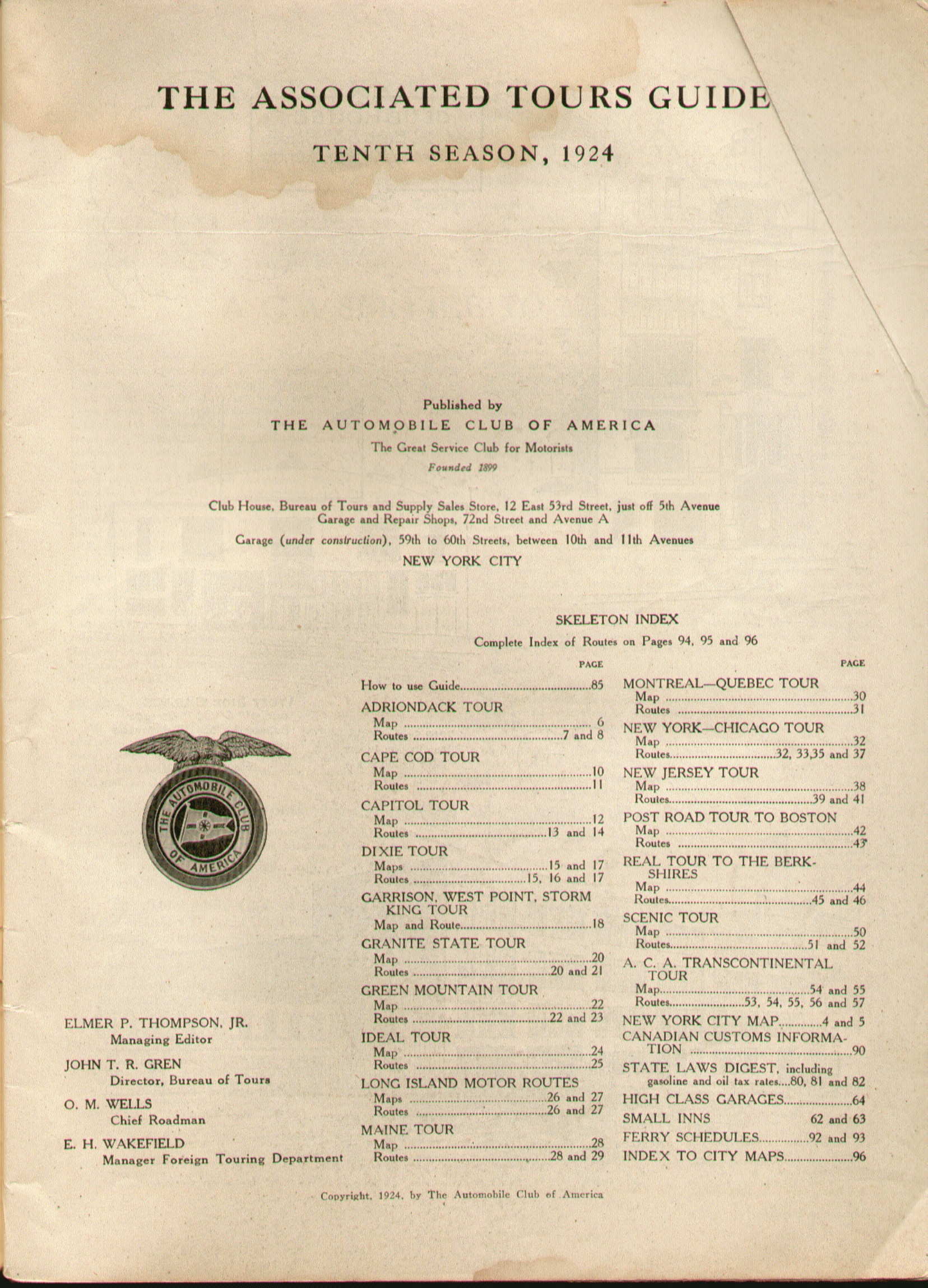
1924 ASSOCIATED TOURS GUIDE 1924. The Automobile Club of America, New York City. This is a later edition of the 1917 and 1919 editions shown elsewhere here. It has 96 pages and the layout is the same, maps and route directions for specific tours as listed on the title page . The Capitol Tour, which includes eastern Pennsylvania, is shown here on pages 13 , 14 , with the map shown at left. It can be compared to the same tour shown for 1917 and there are changes. This edition also has more pages devoted mostly to ads and general information like trip planning. These Associated guides used (what became) a modern atlas format early but were not true atlases as they show only specific tours. Size: 11.5 x 8.5 inches. 3105 | |
|
1924 PAVED ROADS OF THE NATION. Road Distances Pole Markings. The Clason Map Co. Chicago - Denver. The Clason atlases are typically undated, but this is believed to be the 1924 edition. It has a format like the 1923 first edition but a fancier cover and some pages of text in the front. The maps have the same title and one page format as the 1923 maps, but have been updated. The Pennsylvania example is shown at left. Size: 11.25 x 9 inches. 4279 |
|
|
1924 RAND MCNALLY OFFICIAL AUTO TRAILS MAP PENNSYLVANIA, NEW JERSEY. Copyright 1924 by Rand McNally & Co. Chicago. These booklets change significantly in 1924. The District number system is gone and the booklets are made for individual states, here Pennsylvania and New Jersey. The large folded map in the back, here 28 x 34 inches, is still there but now is a map of Pennsylvania on one side, shown at left, with New Jersey on the verso. At the bottom, 97 marked trails are listed, not all in Pennsylvania. The map also shows the condition of roads: paved, improved, dirt, or under construction. The contents still consist of alphabetical town listings, but these are revised and expanded as illustrated here by pages 44-45 with a map of Erie. There are also additional information pages and few ads in this 132 page booklet. Size: 7.5 x 4 inches. 3045 |
|
|
1924 RAND MCNALLY JUNIOR AUTO TRAILS ATLAS OF THE EASTERN UNITED STATES. Copyright 1924, by Rand McNally & Company, Chicago. Rand McNally first began issuing quarto size road atlases in 1924, and this is one of them. It was made as an advertising supplement for a newspaper, and is a 52 page road atlas with a greenish cover with the newspaper ad on front. The coverage extends as far west as Iowa. Most states have double page coverage, as does Pennsylvania in the map shown at left. All the state maps have the Rand McNally "F" code for 1924. There is a United States map in front and a list of tourist camp sites, no motels yet. And there is a milage map in back. Size: 12 x 9 inches. 4441 |
|
|
1924 AUTOMOBILE ROUTES TO FLORIDA SEASON 1924-1925. Published by American Automobile Association, Washington, D.C. This 118 page book looks like a modern road atlas but really isn't. Like the Associated Tour Guides shown elsewhere here, it consists of a description of routes, some with accompanying strip maps, some without. Shown here are pages 22-23 , 24-25 ; Routes 14 (Cleveland to Pittsburgh) and 15 (Pittsburgh to Washington, Pa.) are described by text only, while Routes 16 (Pittsburgh to Bedford), 17 (Bedford to Gettysburg), and 18 (Harrisburg to Washington, D.C.) have strip maps. In the front is an Index Map, shown at left, which displays the routes included. Size: 11.25 x 8 inches. 3316 |
|
|
1924 AUTOMOBILE TOURS POCKET EDITION, Compliments of Willard Storage Battery Co. Copyright 1924 Autoguide Publishing, New York. This small atlas has 256 pages and just one map of the United States shown at left. The pages of routes give miles between cities as shown on page 87 for a route between Scanton and Erie. And, yes, it really does fit in your pocket. Size: 4.5 x 3 inches. |
|
|
1925 CLASON'S TOURING ATLAS OF THE UNITED STATES Road Distances. Logs of National Trails. The Clason Map Co. Chicago - Denver. The Clason atlases are typically undated, but this is believed to be the 1925 edition as the map for Colorado is dated 1925. Starting with this issue, and until 1931 when they ended publication, the Clason atlases had a peculiar format. The 12 x 8.5 inch cover, shown at left, opened to a 12 x 16 inch folio size with pictures as here . This then opened to display the folio size maps. The one for Pennsylvania is shown at left. Size: 12 x 8.5 inches. 3320 |
|
|
1925PENNSYLVANIA TOURIST GUIDE, Issued by the State Publicity Bureau, Pennsylvania Chamber of Commerce, Harrisburg, Pa. This 45 page booklet has an ad with a strip map on the back cover . Inside are similar strip maps with routes between towns such as on pages 28-29 . The trail names of highways are used as illustrated on the map to the left, i.e. Lincoln Highway, Lakes-to-Sea Highway, etc. There are short blurbs describing towns, and also many ads and photos throughout. Size: 10.25 x 7.5 inches. 1079 |
|
|
1925 NUFOLD ROAD GUIDE PENNSYLVANIA, NEW JERSEY, ADJACENT VIRGINIAS DELAWARE, MARYLAND. Improved Highways Main Connecting Roads Mileage and Highway Numbers City Maps and Routings Hotels and Camps. United States Survey Company, Rochester, N.Y. Quite a lot to get into an 80 page booklet, but a lot of it is done with the large 26 x 40 inch map folded into the back and shown at left. Routes are marked in red and the new (then, now old) state route numbers are used. Paved, unpaved, and unimproved roads are indicated. An example of a city map and route directions can be seen on pages 22-23 for Gettysburg. Both the front and back cover, with a Gulf ad, are shown at far left. A Nufold guide for the Northeast is shown below. Size: 9.5 x 5 inches. 1271 |
|
|
1925 NUFOLD ROAD GUIDE UNITED STATES NORTHEAST AND ADJACENT CANADA. Published by United States Survey Company, Rochester, N.Y. This 56 page booklet has the small 9 x 14 inch Key Map shown at left, and a large 27 x 40 inch map titled 'United States Northeast' folded into the back. The front pages have an alphabetical list of towns and the remainder give numbered routes such as pages 38-39 . Some of these routes correspond to the Rand McNally 'Auto Trail' numbers and some to the 1925 state highway number system described below in the Pennsylvania Facts booklet. Size: 9.5 x 5 inches. 128 |
|
|
1925 OFFICIAL NATIONAL SURVEY MAPS WITH DESCRIPTIVE GUIDE AND HISTORICAL NOTES ILLUSTRATED. In this Volume Pennsylvania - New Jersey - Maryland - Delaware - District of Columbia and Route Maps for all Eastern States - Canada to Florida. Published by the National Survey Company, Chester, Vermont. In the front of this 150 page book is an index map shown at left for most of the maps included. Map 72 , for example, covers the eastern tip of Pennsylvania along with a page of city maps. The Pennsylvania maps are shown on pages 51-98, New Jersey maps on pages 101-132, Maryland, Delaware and D.C. maps from pages 134-137. Following are several pages of east coast maps. Accompanying the maps are city listings in alphabetical order such as some "Bs" shown here for Pennsylvania. Books like this were published for Pennsylvania alone and one is shown below. Size: 9 x 5.5 inches. 1379 |
|
|
1925 OFFICIAL NATIONAL SURVEY BOOKFORM MAPS WITH DESCRIPTIVE GUIDE AND HISTORICAL NOTES, INDEXES AND ILLUSTRATIONS In this Volume Pennsylvania. Published by the National Survey Company, Chester, Vermont. Like the guide above, the cover on this one is a little indistinct, so the title page is shown at far left, with a slightly different title than that on the cover. This book has 120 pages and covers only Pennsylvania. The index map, shown at left, is identical to the one above but the indexing overlay has changed. Most of the maps of the state and all of the town listings are identical to the book above. The juncture of Cambria, Clearfield, and Indiana counties is shown here . The 'Bookform' in the cover title is intended to contrast with the large wall map also made by National Survey. Size: 9 x 5.5 inches. 3100 |
|
|
1925 AUTO ROUTE DISTANCE ATLAS OF OHIO, MARYLAND, DELAWARE, PENNSYLVANIA, AND NEW YORK. Published by The Pittsburgh Press. Copyright by C.S. Hammond & Co., N.Y. Pennsylvania is spread over three pages of this 16 pages atlas. The page with the western part is shown at left. The pages with the central and eastern parts are identical to those shown for the Hammond atlas below, and a few of the other maps are also identical. These atlases were typically undated but this particular one can be dated to 1925 by the ad on the back referring to 16 years since 1910. Hammond produced these cheap paper atlases as complimentary handouts and this one probably was a newpaper insert. Size: 13.5 x 10.25 inches.0073 |
|
|
1925 AUTO ROUTE DISTANCE ATLAS OF NEW ENGLAND, NEW YORK, NEW JERSEY, PENNSYLVANIA, MARYLAND AND DELAWARE. Compliments of the State Trust Company Plainfield, New Jersey. Copyright by C.S. Hammond & Co., N.Y. This 16 page atlas has no date but the cover and some maps are identical to the atlas above and so this one is dated the same. Hammond supplied these for complimentary use by banks, insurance companies, etc. Pennsylvania has a two page spread showing the eastern and central parts. Most of the red numbers printed in overlay are mileages between the red dots. The new 1925 state route numbers are also shown for a few routes. Size: 13.5 x 10.25 inches. 3499 |
|
|
1925 PENNSYLVANIA AUTO TRAIL ROAD GUIDE. DuBois Road Directory Co. DuBois, Pa. The 1924 edition of the guide from DuBois Road Directory is shown above. This one also has 80 pages filled with route directions such as those on pages 54-55 . Like the previous guide, this one has an attractive and unusual map, of 23 x 30 inches, folded into the back and shown at left. It differs from the 1924 map and is printed by the National Printing Company of Pittsburgh, and dated to 1924. The back cover displays a strip map route between Morgantown and Buffalo passing through Dubois, a combination of today's routes US 119 and US 219. Size: 13.5 x 10.25 inches. 3131 |
|
|
1925 OFFICIAL 1925 AUTOMOBILE BLUE BOOK MIDDLE ATLANTIC AND SOUTHEASTERN STATES, PA., N.J., DEL, MD. VA., W.VA., D.C. TENN. N.C. S.C., MISS., ALA., GA., FLA. Copyright 1925 by Automobile Blue Books, Inc. Chicago. This 722 page book is similar to the previous edition. At the front are some "highway system" maps, the one for eastern Pennsylvania is shown at left. The Route Chart and General Index Map are similar to the previous edition; as are the route directions illustrated here by some routes for the northwest on pages 308-309 , plus a small map of Oil City. Size: 9.25 x 5.5 inches. 3279 |
|
|
1925 GRANT'S AUTO ROUTE GUIDE VOL. 1. NORTHEASTERN EDITION. Published by The Evans-Brown Company, Inc. New York. Copyright 1925 by Homer D. Grant. The title page says there are 15 Route Maps and 118 special city maps in this 217 page guide. Route Map -7 shows south central Pennsylvania and northern Maryland and the following pages 70-71 show some route directions for the area as well as a map of Altoona. Folded into the back is the 18 x 33 inch General Index Map shown at left with the numbered routes marked in red; and this guide uses its own route numbers. The flyleaf in the front has a colorful collection of route signs, some showing that states like Pennsylvania, Ohio, and others had started marking their routes. Size: 9.25 x 4.5 inches. 3295 |
|
|
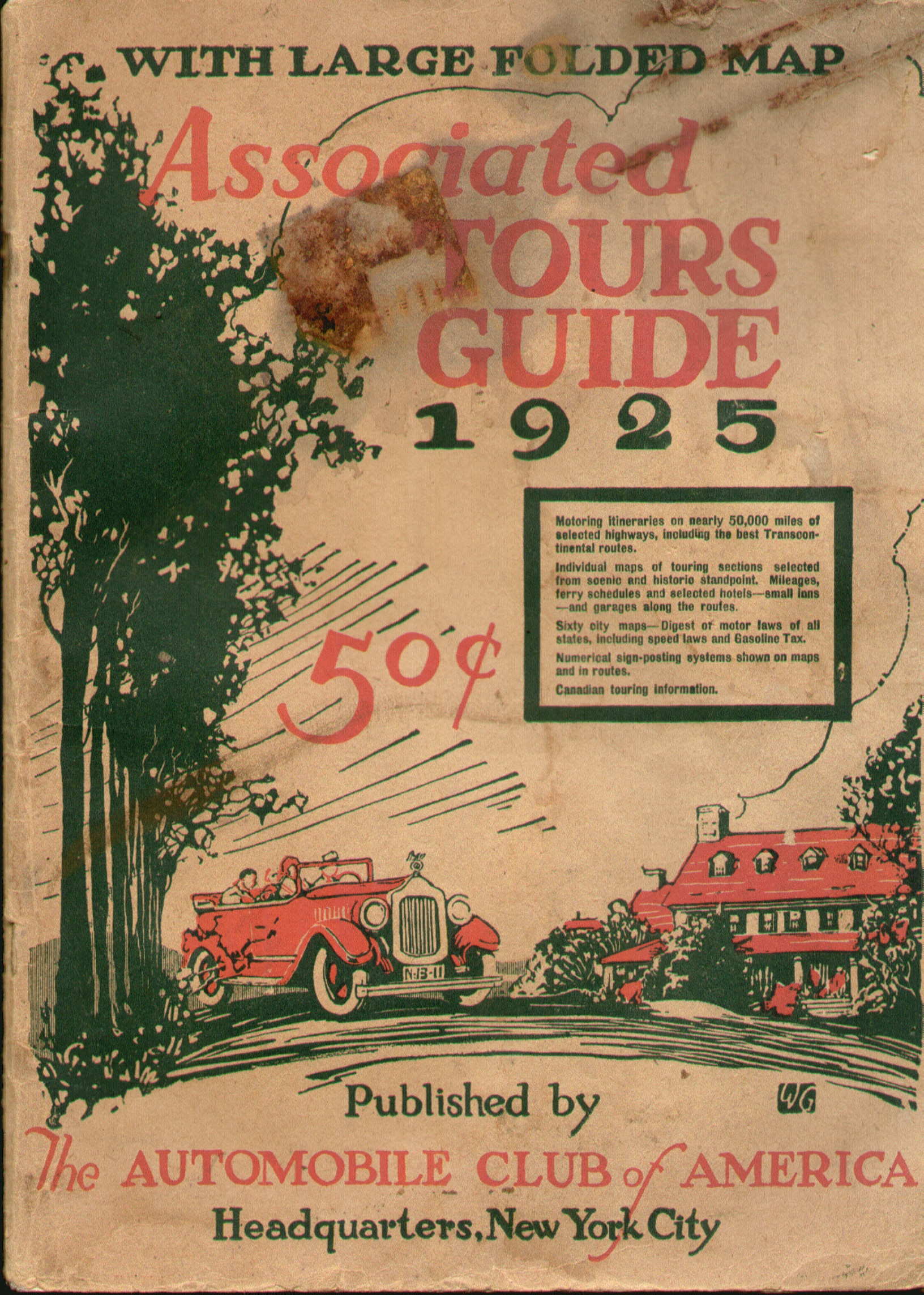
1925 ASSOCIATED TOURS GUIDE 1925. Published by The Automobile Club of America, Headquarters, New York City. The previous edition is shown for 1924 above. This edition has the same number of pages, but there are changes. The tours are listed on the title page and a comparison shows the West Point and Montreal-Quebec tours are dropped here. The big change with this edition is the large folded 22 x 32 inch map attached in the back with all the tour routes printed in red. The New York - Chicago tour is shown here on pages 44-45 , 51 , 52 ; and can be compared to the previous version shown for 1919. There are changes in the routing, including a trip around Lake Erie. A page of the city maps throughout is shown at left with Philadelphia and Pittsburgh. Size: 11.5 x 8.25 inches. 4009 |
|
|
1925 RAND MCNALLY OFFICIAL AUTO TRAILS MAP PENNSYLVANIA. Copyright 1925 by Rand McNally & Co., Chicago. This 80 page edition drops New Jersey from both the text and large 28 x 34 inch folded map shown at left, now with blank verso. The 1925 state routes have been incorporated as the keystone with a '2' inside at the bottom of the map shows. The text is similar to previous editions, an alphabetical list of towns with a few maps as shown here by pages with Bethlehem. Size: 7.5 x 4 inches. 1315 |
|
|
1925 PENNSYLVANIA FACTS MOTORISTS SHOULD KNOW. Department of Highways Harrisburg, Penna. The state began to take its highways more seriously in 1925 with the first edition of this 40 page booklet for motorists. Also, the first free "official" state road map appeared in 1925 (see State Road Maps ). The cover at far left shows Pine Creek Gorge, also called Pennsylvania's Grand Canyon. The state assigned route numbers to roads and put up route signs and the first routes are shown on the map at left. Most of these are still recognizable, though under different numbers. Route 1 is today's US Route 30, the Lincoln Highway. Route 7 is today's US Route 6, and so forth. The booklet contains short articles from state officials shown here ; and there are articles from the state's two US senators, from Mary Roberts Rinehart, the author, and others. There are lists and descriptions of historical sites and points of interest, a few strip maps with routes between cities, street maps of Philadelphia, Pittsburgh, and Gettyburg, and many photos throughout. "Thousands of miles of improved highways today enable the average citizen to know his state as it was never possible to know it in the old days when a fleeting glimpse from a train window was about all the traveler saw..." Size: 9.25 x 12 inches.0452 |
|
|
1925 MIDLAND MOTORWAY, MacNair Motorways, Inc. 1457 Broadway, New York. This 72 page booklet is dated from the index map in front and shown at left. The region covered is from New York and Philadelphia to Chicago and St. Louis. It contains route maps, a few city maps although none of Pennsylvania cities, and driving directions. An example of the driving directions and a route map from Chambersburg to Harrisburg is shown on pages 8, 9. An ad on the back lists three other similar booklets and two of them, Atlantic Motorway and Metropolitan Motorways, include Pennsylvania. 1925 appears to have been the only year of issue for these booklets. Size: 9 x 4 inches. |
|
|
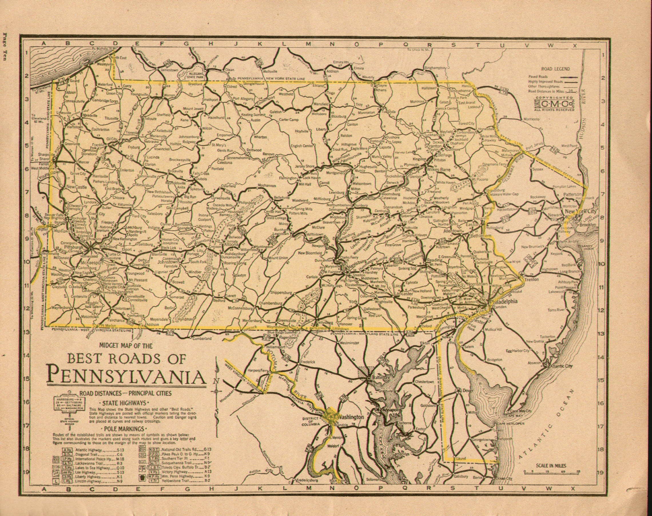
1925 THE BEST ROADS OF ALL STATES, The Clason Map Company, Chicago. This road atlas is dated 1925 in the Milwaukee Journal Tour Club logo on the front; there is also a Journal newspaper ad on the back. The map predates United States routes, roads use trail names or 'pole markings' as Clason calls them. The maps are based on the Clason 'midget' road maps as the Pennsylvania map to the left shows. This same atlas has been seen with other ads on the front, the Philadelphia Public Ledger newspaper, for example. One of the earliest road atlases, with a smaller format than the 1925 Clason atlas shown above. Size: 11 x 9 inches. |
Copyright 2009 by Harold Cramer.
All rights reserved.
Revised September, 2010; August, 2011; May, 2020.